Trammap Pyongyang, North Corea |
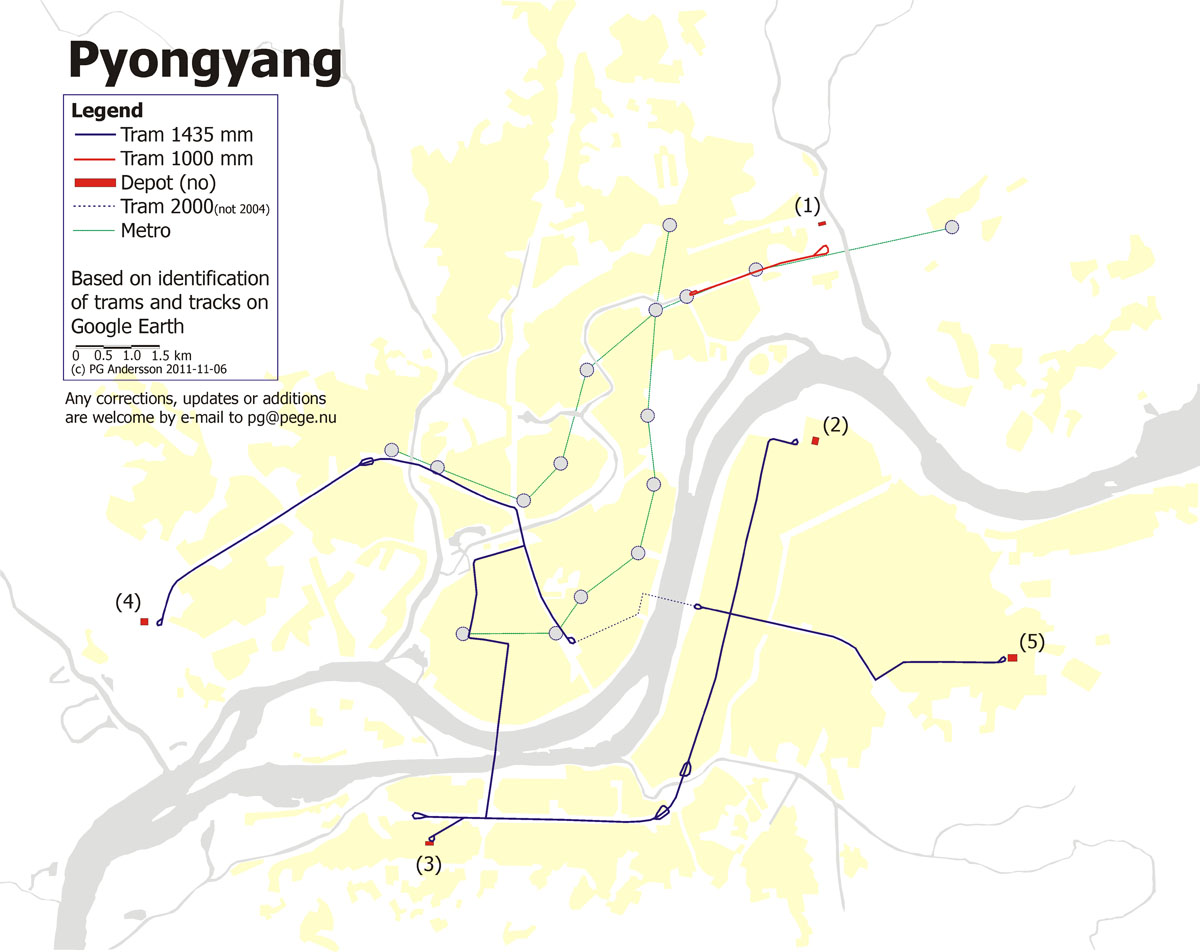
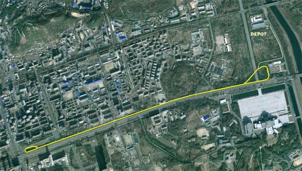
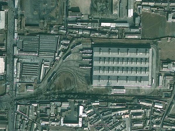
It is always exiting to try to find information about tramways where there are not that much information to find. The capital of North Corea, Pyongyang, has a tram system but there is not that much information about it. I have used the interesting satellite photos of Google Earth to identify tram tracks and tram cars in the streets of Pyongyang. The result is the map below and also some copies from Google Earth of the five identified depots in the city. The tramline in the northeast of the city (red on the map) is a meter gauge route operated by used tram cars from Zürich in Switzerland. For more information
about the trams in Pyongyang visit these links: -------------------------------------------------------------------------------------------------
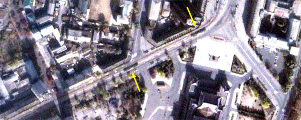
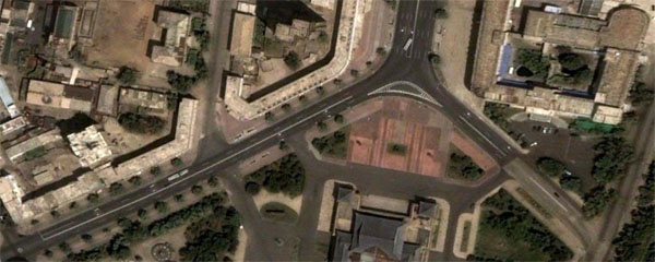
If you have any corrections, updates or additions please send them to me by e-mail. Even if the system is rather new - there are identified a closure in the net (dotted on the map). On GoogleEarth from November 2000 it is easy to obesrve tram tracks an trams between the station and the east side of the Chain Sling bridge. On the picture from June 2004 the street is newly renovated and there are no tracks any more.
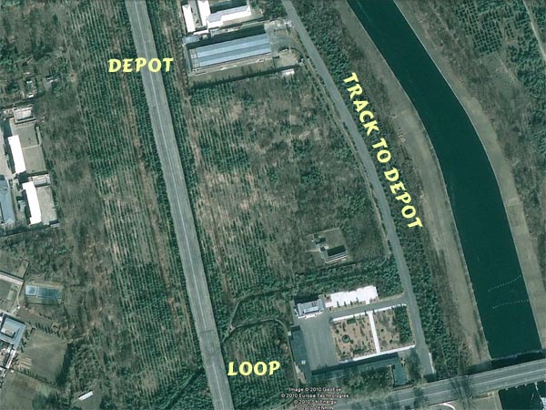
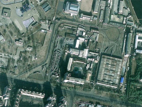
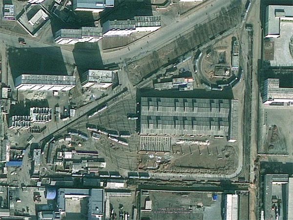
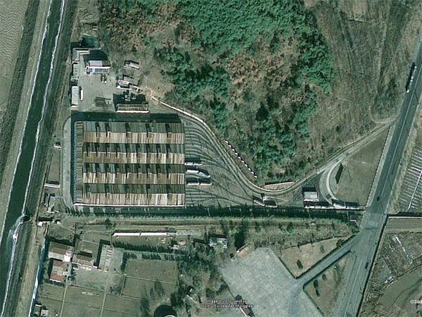
Below the layouts of the five idenntified depots and the meter gauge line in the north east. This line connects the metro with the mausoleum of King Il Sung.
----------------------------------------------------------------------------------------------- |
- |
©PG Andersson, 2010 |